SLC S22W1 / Basic Concepts of Digital Cartography.
3 comments
Make a freehand map of your country.
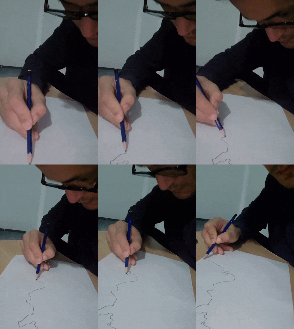
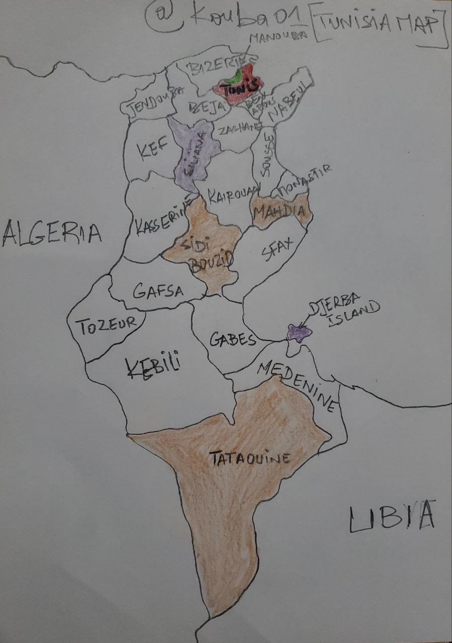
I start by tracing the outline of Tunisia, taking care to precisely represent its borders, particularly those shared with Algeria and Libya, then I divide the interior into 23 zones to represent the governorates, I use simple lines to mark the limits between each governorate, once the areas are defined, I name them one by one by carefully writing the names of the governorates like Tunis, Sfax, Sousse, and the others, I pay attention to the spelling and readability so that each name is clear, finally, I add the names of neighboring countries to complete the map and offer geographical context.
.gif) |  |
|---|
Within the freehand map you made, locate where the capital of your country is and where the state where you live is.
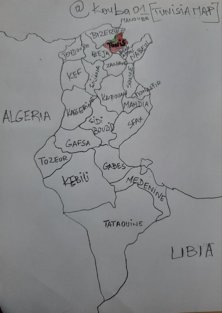
I start by carefully examining my map in order to identify the governorate of Tunis, which is the administrative and political center of my country. Once located, I decided to mark the exact position of the capital, Tunis, using a distinct red marker , in order to highlight its national importance, I take care to choose a strategic position in the center of this governorate so that the landmark is clear and easily identifiable for anyone looking at the map.
Then, I concentrate on the location of the place where I live, which is in the western suburbs of Tunis, precisely in Mannouba, to represent this place, I use a green marker, different from the red of the capital, in order to to differentiate the two places while maintaining a certain harmony in the visual presentation.
 |
|---|
Within the map you made, locate some states/departments/provinces that you know by heart.
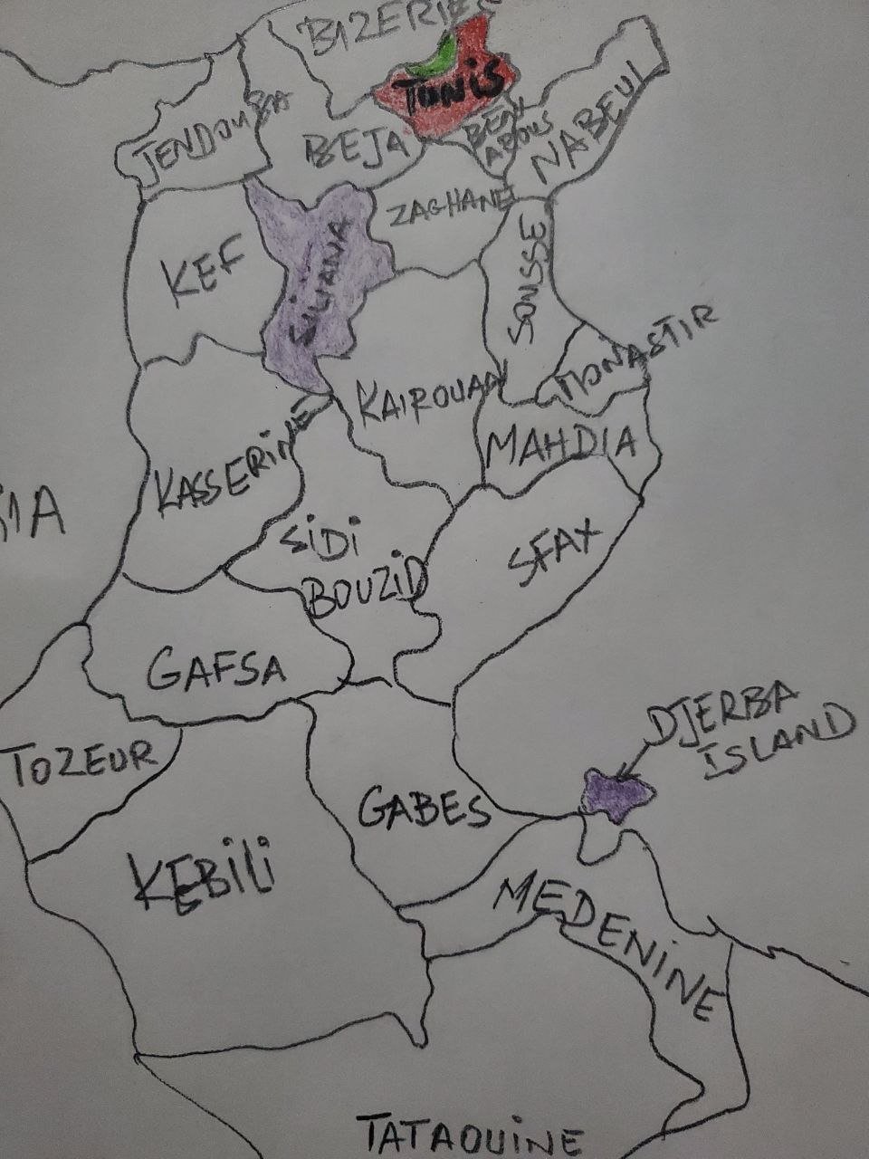
First of all, I identify on my map the two governorates that occupy an important place in my life, marking them in purple to distinguish them from the other regions. The first region I spot is Siliana, where I taught for 12 years, since 2007, building memorable memories and strong ties with this community, then, I locate Djerba, an island which holds a special meaning for me, as I spent most of my vacations there, taking advantage of its exceptional setting and its soothing ambiance, this island also has a family value, being the birthplace of my father, I ensure that these two locations are clearly visible and easily recognizable on the map, in order to reflect their personal importance and the memorable moments I experienced there.
 |
|---|
Mention 3 places that you still don't know about in your country and that you would love to visit and why.
 |
|---|
There are three governorates in Tunisia that I have never visited but would like to explore for special reasons, the first is Mahdia, a place I plan to discover soon, as it is the city where the new husband resides of my sister, this visit will be an opportunity to strengthen family ties while discovering this coastal town rich in history and natural beauty, the second is Tataouine, a place full of personal history, because it is the country of origin of my grandparents, I feel a deep desire to go there to better understand my roots and explore this region famous for its picturesque landscapes and unique traditions, finally, there is Sidi Bouzid, a governorate that I wish to visit out of pure curiosity and to complete my discovery of all the governorates of my country, it is a region that I have always wanted to know more for its cultural and historical importance in the Tunisian context.
a) What is a map for you?
For me, a map is much more than a simple illustration, it is a graphic and visual representation of a specific geographical space, whether it is a city, a region or a country, it allows us to understand and visualize the boundaries geographical and political which define a given territory, while highlighting the cultural, economic or natural characteristics which make it up, a map is like a window on a specific place, offering an overall vision of its configuration, its reliefs, its resources and the elements that coexist within them, it is a tool essential for navigating, analyzing or even planning in different contexts, whether for traveling, studying or managing resources, it synthesizes a multitude of complex information into a single image, thus making accessible what would otherwise be difficult to understand.

b) In your opinion, what are the most important elements to understand a map and why?
I think that to understand a map well, some elements are absolutely essential, because they allow to decode the information it contains and to get its full potential.
First of all, the title of the map is fundamental, since it immediately gives a clear idea of the subject or space represented, without a title it would be easy to get lost or misinterpret the visual data, the coordinates also play a role a determining role since they make it possible to precisely locate a place on the map, these coordinates are essential to situate a particular point in a wider geographical context,
In addition, the conventional signs present on a map are of great use, these standardized symbols make it possible to identify elements such as roads, rivers, mountains or even human infrastructure, thus making the reading of the map intuitive and efficient, finally, the legends occupy a crucial place, because they explain the meaning of the colors, shapes and symbols present on the map, they provide the keys to correctly interpret the data and allow a global and detailed understanding of the place represented.
c) In your opinion: Is cartography important or not so important? Why?
For me, cartography is of paramount importance because it constitutes an essential tool for understanding our position in the world and for exploring the environment around us, it allows us to locate ourselves in a precise space and to understand the relationships between different locations better.
Cartography is not limited to representing territories, it also serves to analyze the resources available in a region, which is crucial for effective and sustainable management, for example, through mapping it is possible to identify areas rich in natural resources to plan infrastructure or even to provide responses to natural disasters, in addition, cartography has a valuable historical dimension, because it constitutes a testimony of geographical, economic and cultural changes over time.
It plays an essential role in the study of the evolution of societies and territories, moreover, in an increasingly globalized world, it helps to create links between regions and countries, by facilitating exchanges and mutual understanding.
Thank you very much for reading, it's time to invite my friends @sahar78, @stream4u, @fombae to participate in this contest.
Best Regards,
@kouba01

Comments